
 KYTX CBS19
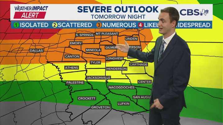
TYLER, Texas — Howdy East Texas!
We heat up Sunday afternoon, building lots of thunderstorm energy that will blossom into a late Sunday night and Monday morning severe weather threat in East Texas. Damaging wind gusts and flash flooding will be possible starting around 9 PM Sunday and lasting until about 4 AM Monday.
More rain and scattered thunderstorms are possible off and through next week. A quieter but hotter weather pattern arrives for the middle of the month.
TONIGHT:
Warm and muggy conditions will continue into tonight with a chance to see some scattered strong to severe thunderstorms along and north of I-20. Low temperatures will be in the low to mid 70's.
SUNDAY:
We'll become hot and muggy once again with high temperatures in the low 90's with feels like temperatures crossi