
 FOX 8 News
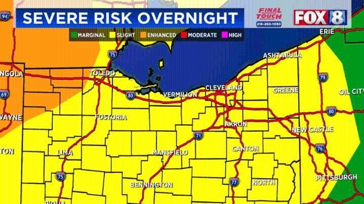
(WJW) -- Showers moving in from the west are weakening and were expected to be gone by lunchtime. The rest of Thursday will be dry, warm and humid. Temperatures will quickly climb into the low to mid-80s but will feel warmer with the humidity and the sunshine.
Overnight, a cluster of storms will develop along the warm front moving west to east between 1 a.m. and 6 a.m. Some storms will be strong to possibly severe, producing strong, straight-lined winds, large hail and heavy downpours.
Here's a look at the Thursday night and Friday future radar:
Another front late Friday and into early Saturday will bring scattered showers and an isolated thunderstorm. It'll have smaller coverage compared to the Thursday night storms.
Humidity drops Saturday afternoon and Sunday, and continues to stay

 WFMY News 2
 WRBL News 3