
 4 News Now
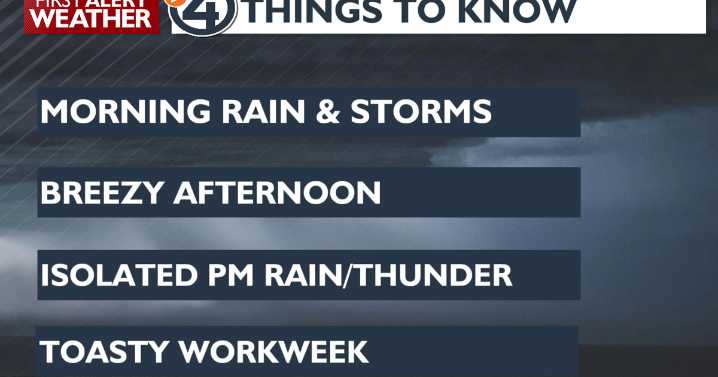
Rain and the occasional lightning strike will keep us on our toes Monday morning, but conditions look to be improved for the afternoon. Breezy weather, cooler afternoon temperatures and only isolated showers and storms in a few areas will make for a decent end to the holiday weekend.
What We're Tracking
Widely scattered AM rain and storms 🌦️
Isolated shower/storm coverage in our northern valleys in the afternoon: Boundary, Bonner, Pend Oreille, Stevens, Ferry, & Okanogan counties
10 to 15 degrees cooler this afternoon 🌡️⬇️
Temperatures start warming again Tuesday
Highs in the 80s are back Wednesday; hottest day of the year so far 🥵
Next rain chance: Thursday 👀
Planning Memorial Day
Extended Forecast

 WTKR
WTKR KOMU 8
 WAND TV
 Edmonton Sun World
 Spectrum Bay News 9 Technology