
 WEVV 44News
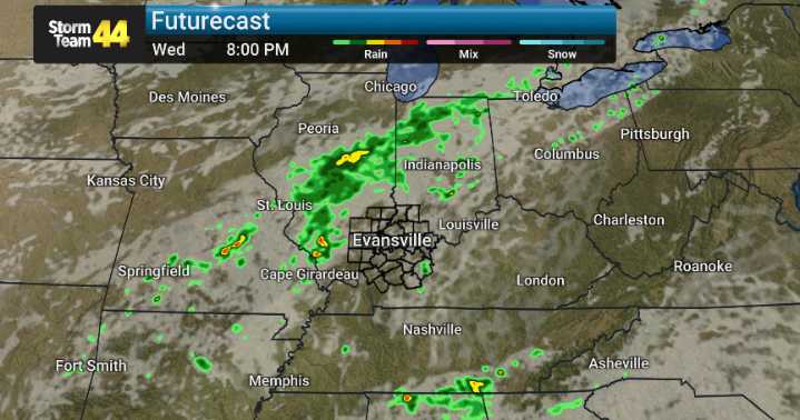
Southerly breezes and hazy skies, a lingering effect of Canadian wildfire smoke, will stick around through this evening. However, a noticeable shift in our weather pattern is set to begin Wednesday afternoon, ushering in an unsettled period that will extend into early next week.
We're keeping a close eye on thunderstorm development, with chances for storms ramping up significantly for Thursday and Friday. While Thursday's storm threat currently appears low, Friday presents a greater potential for strong to severe thunderstorms. This risk is most pronounced across the southern half of our viewing area. This includes areas south of I-69/Western Kentucky Parkway in western Kentucky. The primary concern with any storms that develop on Friday will be damaging winds.
Alongside the storms, expe

 TODAY Video
 FOX News Politics
 FOX 13 Seattle Politics