
 KFYR-TV
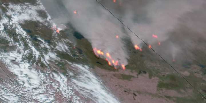
BISMARCK, N.D. (KFYR) - While images of wildfires capture their ferocity, data can provide insight into how bad a fire season is.
Such is the case with two graphics, powered by satellite data, that showcase a Canadian wildfire season off to a wild — and scary — start.
Twice a day, a NASA satellite sends images to the ground, giving a real-time view of where fires are burning. This is especially useful for remote areas where no sensors are stationed.
As of Tuesday, that satellite had picked up four times as many fire hot spots across Canada than is typical for early June. That’s more than any year since the satellite began transmitting in 2012, except 2023, according to data from Global Forest Watch .
Though the satellite has recorded thousands of hot spots so far this year, that doe

 The Jerusalem Post