
 KOMO News Washington
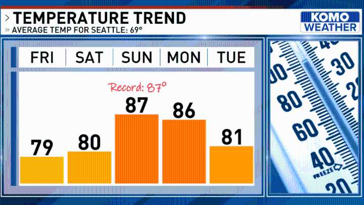
Here comes the heat!
The first lingering "warm wave" of June is on deck, and it will push our highs into the toastiest territory we've seen yet in 2025.
Building high pressure over the Eastern Pacific is nudging in our direction, and it will serve to crank up the mercury over the next several days. With mostly sunny skies on Friday, Seattle and Tacoma will wrap the work and school week with highs hovering near 80.
We'll continue warming from there, with a thermal trough pushing up the I-5 corridor to transport hot, dry air in from Central California over the next 72 hours. As such, temperatures will hit the low 80s Saturday, and middle to upper 80s Sunday near the urban core. Sea-Tac's record high for June 8th is 87 degrees, and we'll be closing in on tying or breaking that by Sunday af