
 WKYT
WKYT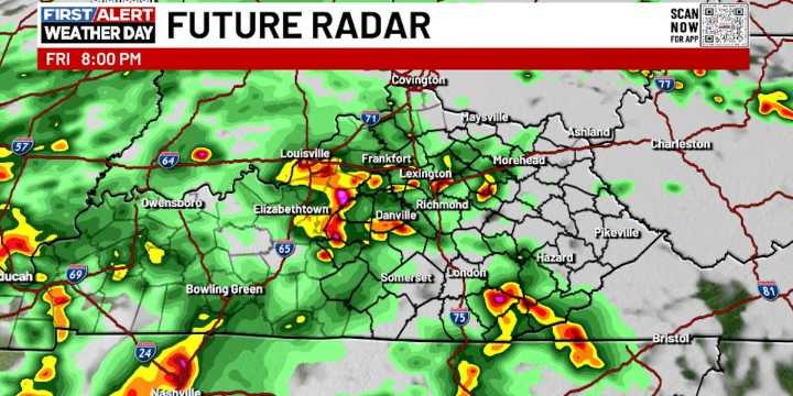
LEXINGTON, Ky. (WKYT) - Severe weather seems to show up on Friday’s here in Kentucky and the threat is with us again out there today as a cold front moves in and slows down. This keeps the threat for strong to severe storms going into the first half of the weekend.
The boundary stalling out allows a few waves of low pressure to roll through here, touching off showers and storms. This is NOT widespread action where it rains and rains and rains. It’s one that features a lot of dry times, but storms roll through and put down a lot of water in a short amount of time. That leads to the potential for flash flooding on a local scale.
As our front sinks in from the northwest, it keeps the threat for a few strong to severe storms will be with us again on Saturday.
Scattered storms linger into Su

 FOX 10 Phoenix National
 Mediaite
 America News