
 The Cullman Tribune
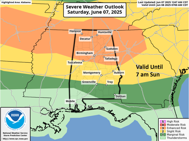
A Mesoscale Convective System (MCS) with a large or several clusters of storms will move across the northern half of the state from late this morning through early evening. In addition, a few severe storms could develop ahead of the MCS. Very heavy rainfall, damaging wind gusts and hail are the main threats. Within the Enhanced Risk area, the potential exists for swaths of wind damage as well as a couple of tornadoes.
After this MCS either dissipates or moves into Georgia, another MCS with a line of storms is forecast to enter the northern portions of Alabama after 10 pm and once again affect mainly the northern half of the state before dissipating by 8 am Sunday somewhere near or north of a Livingston – Montgomery – Auburn line. Although not as potent as the first round, very heavy

 ABC News Technology
 KYTX CBS19 Politics
 NBC News