
 WAAY TV
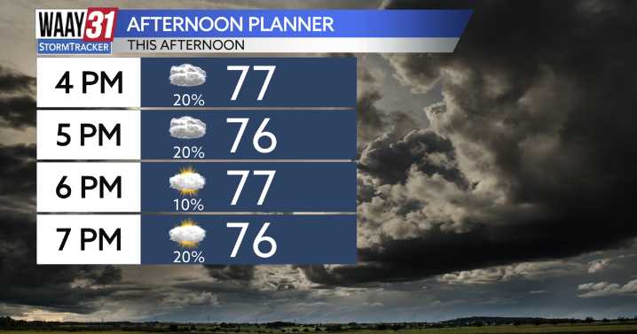
The threat for severe weather has ended for the Tennessee Valley. The storms have moved to the east into Georgia, leaving us with some cloudy skies and a few showers behind the line of storms. Temperatures will sit in the mid 70s, eventually dropping to the upper 60s for lows tonight.
The next round of showers and storms is expected later on into the evening tonight, but the threat is lower than what we saw during the afternoon today.
Sunday morning will have the possibility to see some showers, but by the afternoon we'll be partly cloudy with highs in the low to mid 80s.
More storms are likely on Monday due to a weak cold front, but the remainder of the week will be relatively drier, with isolated afternoon showers and storms possible about every single day. Temperatures will sit in th