
 KWWL
KWWL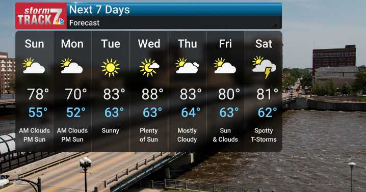
On Sunday, a cold front will usher in a chance of showers and thunderstorms mainly early in the day. Although the primary severe weather risk is expected in southeastern Iowa late Sunday morning and early afternoon. Beyond that, expect gusty winds of 20-30 mph and drier conditions for Monday. Air quality may also be impacted early in the work week with a return of wildfire smoke, so those with sensitivities should monitor conditions. Temperatures will remain below average through Monday, with Sunday seeing a mix of sun and clouds and highs in the upper 70s, and Monday featuring clouds giving way to sun with highs in the low 70s and lows in the low 50s.
As we move into the mid to late week, a warming trend is anticipated, accompanied by increasing humidity. Tuesday will bring sunshine and

 TheWrap
 The Spectator