By Joe Lombardi From Daily Voice
As September draws near, residents across the Northeast are being urged to brace for an active and unpredictable start to fall.
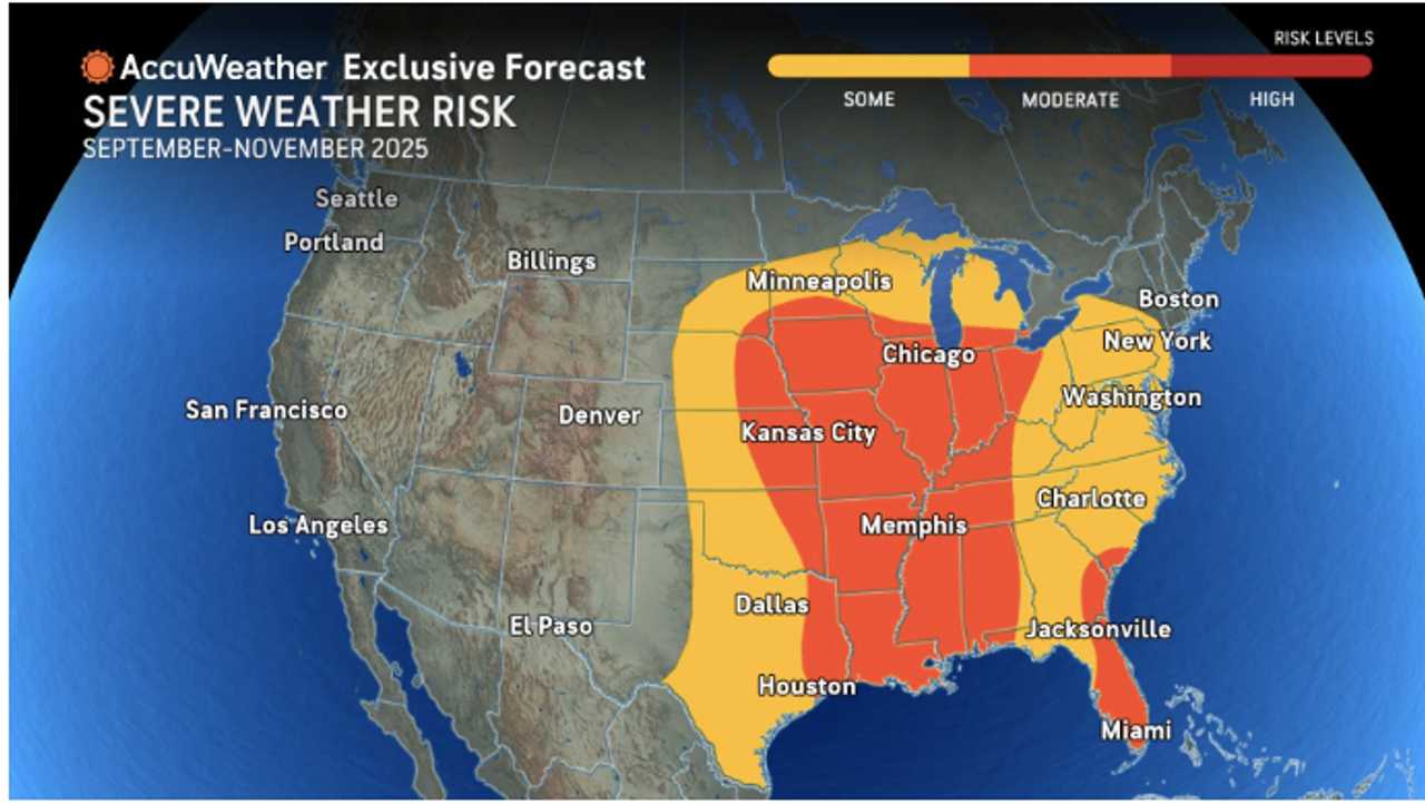
AccuWeather meteorologists are predicting lingering summer warmth and a heightened threat of severe weather.
While meteorological fall arrives on Monday, Sept. 1, true autumn-like conditions may take a back seat in the Northeast.
AccuWeather Lead Long-Range Expert Paul Pastelok states that “hot and sticky summer weather" will linger longer into the back-to-school season across much of the East Coast.
According to AccuWeather, warm and humid air will persist across the region, delaying the crisp, cool weather many look forward to each year.
This extended warmth could help fuel storms during what meteorologists call the nation’s “second severe weather season.”
AccuWeather’s experts warn that the risk of severe thunderstorms and even tornadoes remains elevated this year.
With more than 1,300 tornado reports already filed nationwide in 2025, the forecast has been raised to as many as 1,700 tornadoes across the country.
While the Midwest traditionally sees the most tornado activity, the Northeast is not immune, especially as warm, stormy air lingers.
In addition, abnormally warm Atlantic waters are fostering an active hurricane season. AccuWeather predicts 13-18 named storms, up to 10 hurricanes, and as many as six direct impacts to coastal areas.
Cities along the Eastern Seaboard, including those in the Northeast, could face tropical storms or hurricanes well into autumn.
To complicate matters, smoke from wildfires in Canada and the western US is expected to periodically haze skies across the Northeast, affecting air quality.
Officials urge families and businesses to review emergency plans, restock supplies, and stay alert as the region navigates a fall marked by unusual warmth and increased weather risks.
Check back to Daily Voice for updates.

 Daily Voice

 New York Post
 Newsday
 Raw Story
 The Daily Beast
 NBA
NBA Associated Press US News