
 FOX 9
FOX 9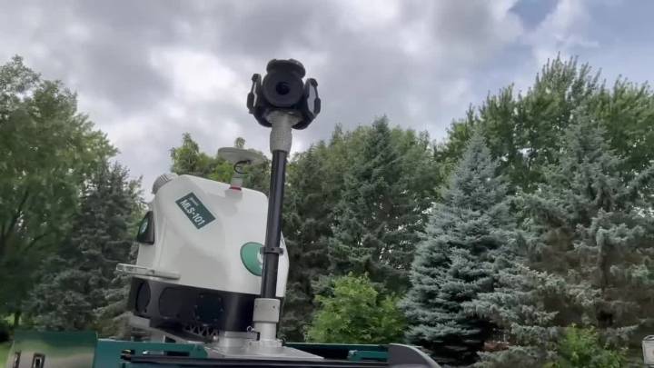
PLYMOUTH, Minn. (FOX 9) - The truck that Conor Logan is spending a couple weeks driving along the streets of Plymouth gets attention for a couple of reasons.
One is the six-camera array on top, which people confuse for a Google car. The other is his speed.
"We can only go a maximum of 23 miles an hour while collecting," Logan explains.
While the cameras get a full panoramic view, it’s the two LIDAR sensors that are doing the work of creating a full digital copy of every tree he drives by.
"It’s collecting a point cloud of the tree," he says, "so that’s a 3-D model at the end."
Creating a virtual tree map
What we know:
Plymouth is the first city in Minnesota to create this virtual tree inventory, signing a contract with two companies, Greehill and Davey Resource Group, to do the

 NBC News
 AZ BIG Media Economy
 FOX 13 Seattle Crime
 AlterNet
 Essentiallysports Motorsports
 ABC News Video
 Essentiallysports Golf