
 News4JAX
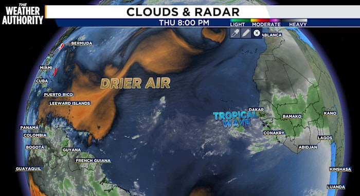
While there are only two spots the National Hurricane Center is currently watching, the tropical Atlantic continues to fuel hotspots.
A non-tropical area of low pressure is expected to form in a day or so a few hundred miles offshore of North Carolina. Some tropical or subtropical development is possible this weekend while the system moves northeastward over the warm waters of the Gulf Stream. By early next week, the low is expected to reach colder water and an area of strong upper-level winds, ending its chances for tropical or subtropical development.
Formation chances for 2-7 days is 10-20%.
A tropical wave over the central tropical Atlantic continues to produce disorganized shower activity. Development of this system appears unlikely during the next day or two, but environmental con

 Local News in Arizona
 The Travel
 The Baltimore Sun
 CNN Climate
 ABC News US
 CBS News
 The Daily Beast
 AlterNet