
 KOLR10 News
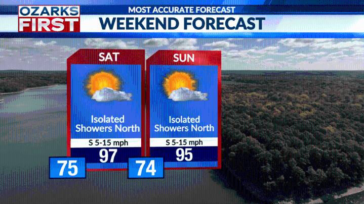
New day, same pattern with another sneaky wave of clouds and showers. Today's helping hand from Mother Nature swept across areas a bit further east, or east of Hwy. 65. Where showers swept through, cooler highs were enjoyed; further west, hot temperatures ruled.
Friday is looking drier and hotter as the summer ridge noses northeast across the Ozarks. This should temporarily shut down the pattern that delivered sneaky rain chances the past couple of days.
Temperatures will be hot, and humidity levels are running higher. A Heat Advisory has been posted for Friday afternoon and evening with "feels like" temperatures as high as 106° during the afternoon.
Weekend weather won't offer much relief. Rain chances will remain very low with afternoon highs in the mid to upper 90s on Saturday. Cloud

 Aljazeera US & Canada
 AlterNet
 RadarOnline
 ABC News Video