
 The Gazette
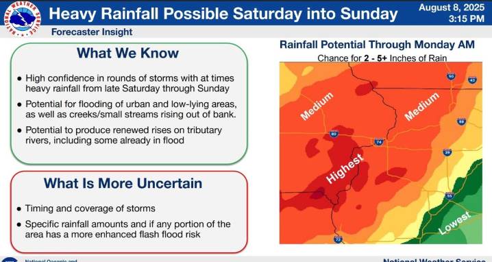
The Gazette offers audio versions of articles using Instaread. Some words may be mispronounced.
A Flood Watch has been issued for much of Eastern Iowa as several repeating rounds of thunderstorms are expected across the area Saturday afternoon through Monday morning.
There is high confidence in rounds of storms with heavy rainfall from late Saturday into Sunday. There’s potential for flooding of urban and low-lying areas. There’s also potential to produce renewed rises on tributary rivers, including some that are already at or near flood stages.
The axis for the highest chance of flash flooding includes Cedar Rapids, Iowa City, Ottumwa and Dubuque. The Des Moines area is also included in the swath where the risk of flash flooding is highest.
Rainfall totals of 3 to 5 inches, with some

 Local News in Arizona
 The Travel
 The Baltimore Sun
 RadarOnline