
 FOX 13 Tampa Bay Crime
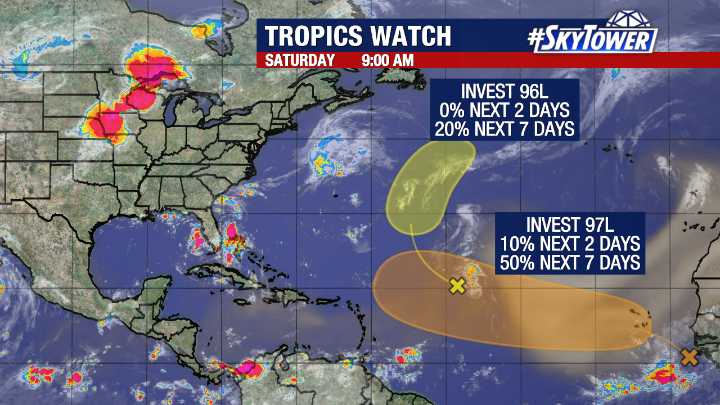
TAMPA - A strong tropical wave (now Invest 97L) moving off Africa will likely become the first hurricane (Erin) in the Atlantic this season.
This will be entering a more favorable environment for development next week and will likely become a named storm within the orange-shaded region.
As always, when a system is that far away, there is a large model spread on where it will go in the long term.
Big picture view:
While most long-range weather models keep this system out of the Caribbean, it's too early to confidently predict where it may go from there.
READ: FOX 13 meteorologists watching two spots in the Atlantic
For now, this disturbance is over 3,000 miles away from our coastline and the United States will have over a week to monitor its progress.
For now, we will just watch i

 WTNH News 8
 FOX 29
 WFTV Channel 9
 The List
 AlterNet
 America News
 CNN
CNN Oroville Mercury-Register Health