
 ClickOrlando
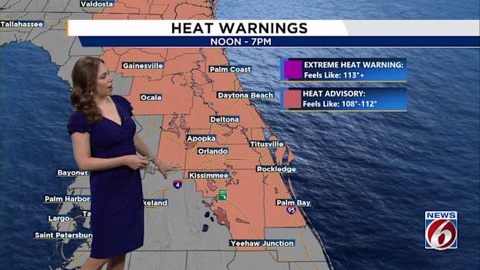
ORLANDO, Fla. – It’s going to be another hot and steamy day across Central Florida, with dangerous heat levels and a few late-day storms in the mix as we keep a close watch on Tropical Storm Erin .
Thursday
A ridge of high pressure is sitting over Florida, limiting how many storms pop up.
Some isolated to scattered storms may fire up inland later in the afternoon, especially where sea breezes meet.
[VIDEO BELOW: Crane topples onto Merritt Island home]
While widespread storms aren’t likely, any that do form could bring gusty winds up to 55 mph.
The heat is the bigger concern. Highs will soar into the mid-90s, especially inland. When you factor in the humidity, heat index values could hit 110 degrees, which is why a heat advisory is in effect from 11 a.m. to 7 p.m.
Expect more of

 13WMAZ
 Orlando Sentinel
 FOX 13 Tampa Bay Crime
 WPTV West Plam Beach
 Seeking Alpha Stock
 Nicki Swift