
 Grand Forks Herald
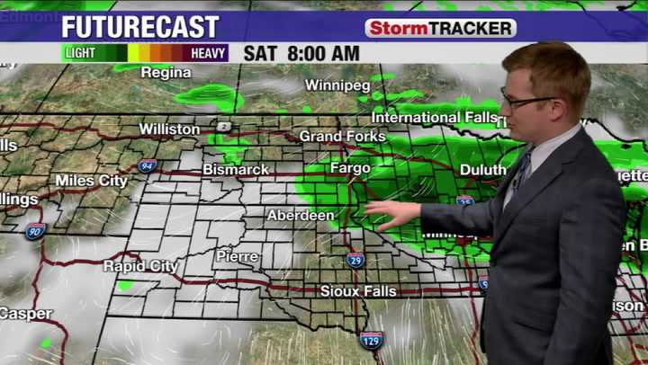
We continue our active wet pattern as we go into this weekend. Storms from overnight Friday in the Dakotas travel east, resulting in showers and t-showers throughout Minnesota and Wisconsin during the afternoon for Saturday. Along with the rain chances, an even wider area of overcast skies look to set in for the day on Saturday as well.
Winds begin to kick up from the East, and that looks to stick around as we go through the rest of the weekend. Temperatures still stay mild today but areas further south retain the heat in the 80s and 90s, while further up north highs are in the 70s.
As we go into Sunday another round of shower and storm chances move into the region. The rain chances look to set up over the Dakotas before moving east. With this more rumbles of thunder are possible in the

 Local News in Maine
 Associated Press US and World News Video
 Newsweek Top
 Eyewitness News 3
 TMJ4 News
 FOX 29
 MyNorthwest
 WMUR TV
 Raw Story