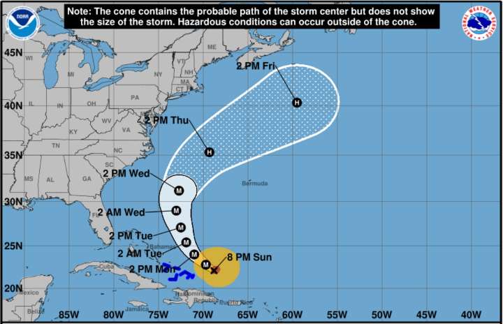
Hurricane Erin continues to track through the Atlantic as a dangerous Category 3 storm as of Sunday evening, but the forecast path remains offshore of the U.S. East Coast.
The monster storm will still send “life-threatening surf and rip currents” across the eastern seaboard, the National Hurricane Center said Sunday in an 8 p.m. update.
Erin was located approximately 155 miles east-northeast of Grand Turk Island, with maximum sustained winds of 125 mph. The storm is moving west-northwest at 13 mph.
“Erin is expected to gradually turn northward in a couple of days,” the hurricane center said. “Erin has been growing in size, and that trend is likely to continue over the next few days. The expanding wind field will result in rough ocean conditions over much of the western Atlantic.”
The N

 The Jersey Journal

 The Traverse City Record-Eagle
 10 Tampa Bay
 Daily Voice
 The Philadelphia Inquirer Crime
 Ledger-Enquirer
 WRCB-TV
 CBS Philly
 WYFF Sports
 AlterNet
 RealClear Politics
 The Daily Mining Gazette