
 FOX 13 Tampa Bay Crime
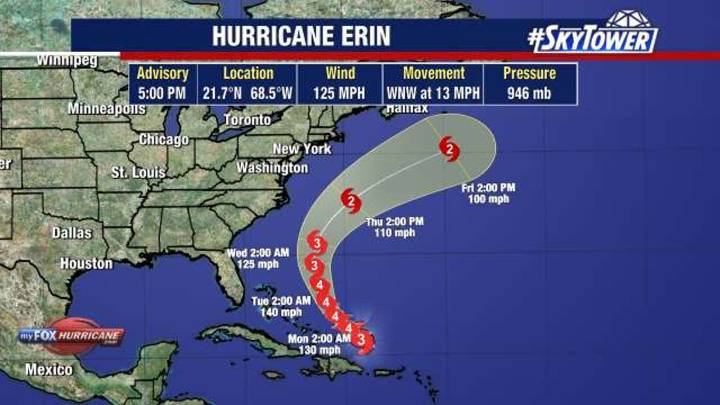
Hurricane Erin peaked at Category 5 strength on Saturday after undergoing an eyewall replacement cycle.
Erin is now a Category 3 hurricane with outer rainbands producing gusty winds and heavy rains across the Virgin Islands, Puerto Rico and the Dominican Republic.
Sustained winds are 125 mph as the storm moves west-northwest at 14 mph. A Tropical Storm Warning is in effect for the Turks and Caicos with a Tropical Storm Watch covering the SE Bahamas.
Erin’s core is expected to pass east of the Turks and Caicos Islands and southeastern Bahamas tonight and Monday.
Local perspective:
The storm is still forecast to make a gradual turn to the north Monday and Tuesday, staying east of the Atlantic Coast.
Some fluctuations in intensity are likely the next few days, with the forecast calling

 WISC-TV Channel 3000
 AccuWeather Severe Weather
 Canada News
 New York Post
 People Human Interest
 The US Sun Latest
 Raw Story
 Newsweek Top