
 Edmonton Sun World
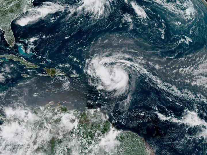
MIAMI — A stronger and bigger Hurricane Erin pelted parts of the Caribbean and was forecast to create dangerous surf and rip currents along the U.S. East Coast this week.
It reintensified to a Category 4 storm with 130 m.p.h. (215 km/h) maximum sustained winds early Monday and moved closer to the Southeast Bahamas, according to the U.S. National Hurricane Center in Miami.
Recommended Videos
Around 5 a.m. Monday, Erin was about 105 miles (170 kilometres) north-northeast of Grand Turk Island and about 915 miles (1,470 kilometres) south-southeast of Cape Hatteras, North Carolina. The storm was moving northwest at 13 m.p.h. (20 km/h).
The Bahamas government issued a Tropical Storm Watch for the central Bahamas, while a Tropical Storm Warning remained in effect for the Turks and Caicos Isla

 Global News
 CTV News
  Canada News
 New York Post
 Yahoo Canada
 Raw Story
 The American Lawyer