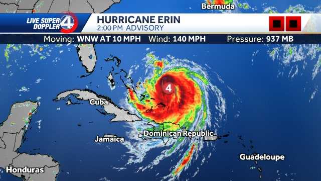
Erin is expected to re-intensify into a major hurricane as it draws closer to the coast.
As of Wednesday, the hurricane is still a Category 2, but it is intensifying as a new eye wall has developed and the storms are better organized. The latest track keeps it "just offshore" of the East Coast, but shows the storm return to Cat. 3 status in the overnight hours.
South Carolina Impacts:
Rip Currents & Surf: The biggest hazard continues to be rip currents, which are already proving dangerous. Swells and surf will build through tonight and Thursday with waves of 5–7 feet possible along the coast.
Rain/Wind: Direct wind and rain impacts remain limited unless Erin jogs west, but feeder bands could spark scattered storms.
North Carolina Impacts:
Outer Banks: This remains the area most at ri

 WYFF News 4

 Times Herald-Record
 WISC-TV Channel 3000
 America News
 CBS News Video
 WCNC Charlotte Weather
 The Atlanta Journal-Constitution Crime
 CBS News
 Raw Story