
 FOX 26 Houston
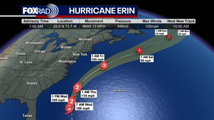
Hurricane Erin is making its turn to head to the north in the Atlantic as it passes Florida's eastern coast.
As of 10 a.m., Erin is forecast to restrengthen into a category 3 hurricane as it passes to the east of the Outer Banks.
Latest news on Hurricane Erin
The latest models have Erin, still a category 2, making a curve to the northeast, moving away from the eastern coast of the United States. Indirect impacts of large swells, coastal flooding and dangerous rip currents are likely up and down the eastern seaboard, especially in coastal North Carolina.
Storm surge flooding and tropical storm conditions are expected in the Outer Banks of North Carolina beginning later today/tonight.
As of 7 a.m. CT, Erin was moving north-northwest at 13 mph and had max sustained winds of 100 mph.
Wha

 America News
 CBS News Video
 WCNC Charlotte Weather
 The Atlanta Journal-Constitution Crime
 CBS News
 The Babylon Bee