
 Massillon Independent
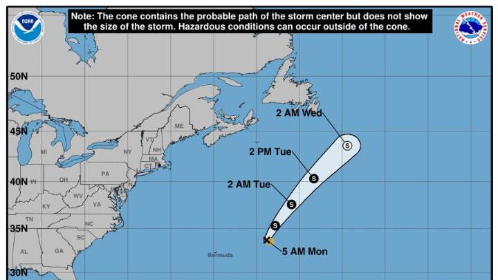
Tropical Storm Fernand formed over the weekend, becoming the sixth named storm of the 2025 Atlantic hurricane season just after Category 5 Hurricane Erin moved out to sea .
Fernand was about 360 miles east-northeast of Bermuda with maximum sustained winds near 50 mph with higher gusts as of the National Hurricane Center's 5 a.m. ET advisory on Monday, Aug. 25 . Forecasters said the storm is expected to move across the open waters of the subtropical central Atlantic well east and northeast of Bermuda.
The storm is moving toward the north-northeast near 12 mph, and this motion is expected to continue for the next day or so, followed by a turn to the northeast, according to the hurricane center. Fernand is expected to begin weakening on Monday night, Aug. 25, and is expected to become

 FOX 5 Atlanta Crime
 KCCI 8
 The Atlanta Journal-Constitution Things to do
 11Alive
 Atlanta News First
 WRDW-TV News 12 Crime
 11Alive Atlanta
 AlterNet
 Raw Story
 RadarOnline