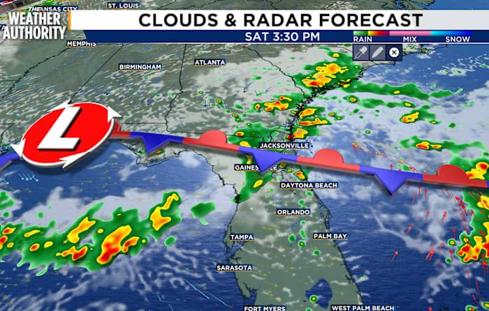
I’ve got good news and wet news.
The good news is that this weekend will be cooler than our typical seasonal temperatures. Usually, we are in the low 90s at this time of year, although record temperatures have approached nearly 100 degrees. Our afternoon highs will only reach the 80s, which leads us to the wet news.
A slow-moving front will mark the boundary between rain and locally heavy storms. The front will stall across northeast Florida before lifting northward on Sunday. North of the front, it will be a bit more stable with periodic rain and isolated storms.
South of the front, an unsettled and buoyant air mass will produce stronger storms and the potential for heavier rainfall.
The chance of rain will start early and persist overnight. The lowest likelihood will be in the mornin

 News4JAX

 WAFB
WAFB KOMU 8
 Sun Sentinel
 Local News in Florida
 The Newport Daily News
 Cache Valley Daily
 Gainesville Sun
 KETV NewsWatch 7
 Battle Creek Enquirer
 FOX 5 Atlanta Crime
 AlterNet