
 Click2Houston
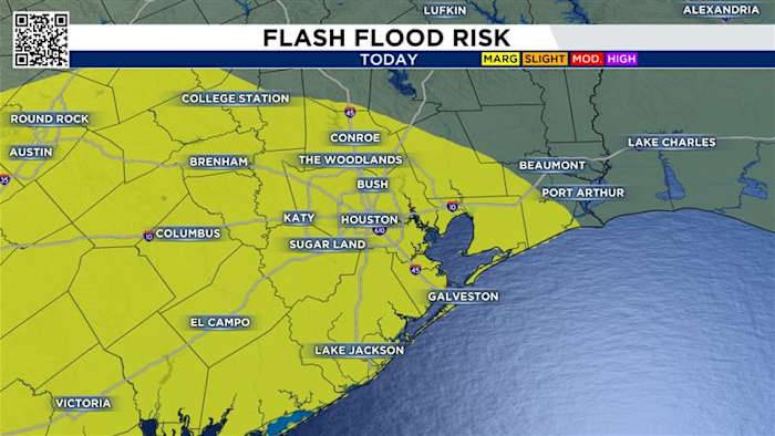
We had quite a busy weekend, weather-wise, with heavy rain, thunderstorms, and street-flooding.
RECAP: Dangerous flooding hits Houston interstates during Labor Day storms
Today’s forecast is just as active, with storms likely to make outdoor plans tricky—especially around lunchtime and into the afternoon. The highest chance of rainfall is along and south of I-10.
You can track radar here:
Today’s Forecast:
Storm chances continue today, but it won’t be as widespread as Sunday, and the flood is 1/4. Yesterday it was a 2/4.
By mid-morning isolated to spotty showers will be possible.
The best chance for storms comes in the heat of the day. You can see at 3PM storm coverage increases, especially closer to the coast.
As we approach 7PM we can still see isolated storms. These storms can

 FOX News
 America News
 AlterNet
 Sarasota Herald-Tribune
 Columbia Daily Tribune
 CNN Business
 FOX 5 Atlanta Crime
 New York Post