
 IFL Science
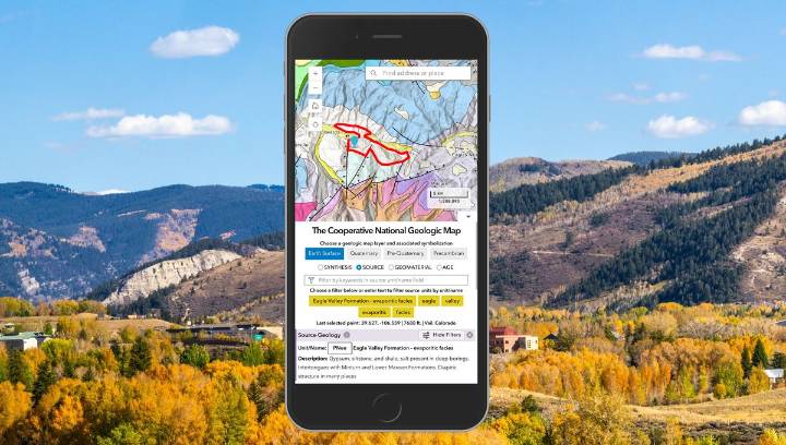
Ever wanted to know more about the ground beneath your feet? Well, thanks to a new geologic map of the lower 48 states of the USA, now you can – and in more detail than ever before. The rest of this article is behind a paywall. Please sign in or subscribe to access the full content.
Geologic maps are pretty much what they say on the tin: maps detailing an area’s geological features, such as different types of rocks and sediments, their age, and how they’re distributed. They’re used in all sorts of ways, not just by geologists wanting to double-check how old a rock formation is, but also in understanding more about possible geological resources – like minerals – and natural hazards such as earthquakes.
That’s why making sure that they contain as much detail as they possibly can is so im

 RadarOnline
 Darkhorse Press
 Tampa Bay Times Health
 IMDb TV
 America News
 PBS NewsHour
 AlterNet
 Mediaite
 Atlanta Black Star Entertainment
 The Atlanta Journal-Constitution Sports