
 21Alive News
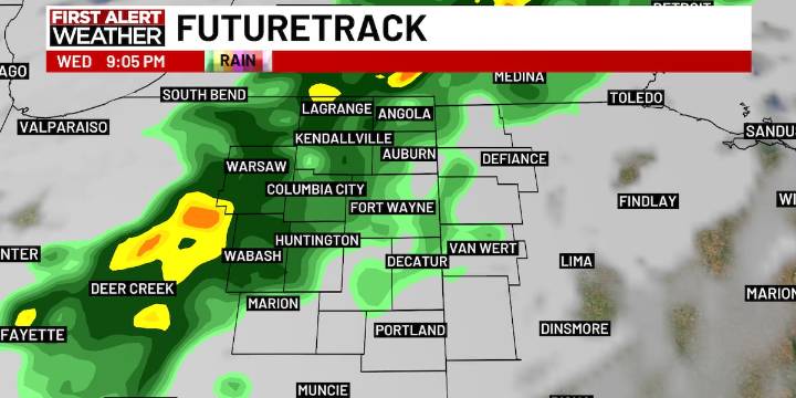
FORT WAYNE, Ind. (WPTA) - Our next cold front arrives by the end of the day, but we’ll top off in the low 80s once more before the cooler air settles in for the rest of the week.
Some patchy fog is possible in low-lying, rural areas as sunrise nears, but this is expected to be short-lived for the areas that do see it. Once the sun comes up, it will be a clear start to the day before more clouds roll in. Rain chances will hold off until this evening into tonight, occasional downpours and even a few rumbles of thunder will be possible overnight. The rain looks to move out before the early Thursday drive, with the rest of the week trending dry.
Behind the rain, much cooler air arrives! In fact, the rest of the week will trend closer to what we typically see for the start of October. Highs w

 KOMU 8
 KFVS12
 Bozeman Daily Chronicle
 NFL Seattle Seahawks
 ABC30 Fresno World
 America News
 NBC News
 ABC News
 Raw Story