
 KPAX
KPAX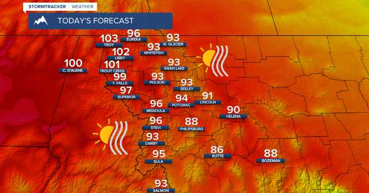
MISSOULA — The ongoing heat wave peaks today with record or near record highs again in the forecast.
The hottest temperatures will again be for locations along the Montana/Idaho border where highs will soar into the upper 90s and 100s.
Things start to change Thursday as a weak cold front moves south out of Canada.
This front won't bring anything as far as rain goes, but it will bring an increase in winds and cooler temperatures. For those with plans to head to the lake tomorrow, choppy lake conditions could develop under these conditions.
Another aspect to this cold front will be the potential for an increase in wildfire smoke from Canada Thursday and Friday.
High temperatures will be in the low to upper 80s Thursday through Saturday. Models continue to show cooler air continuing to m

 FOX News
 News 5 Cleveland Politics
 NBC News
 FOX News Politics
 The Danville Register & Bee Entertainment
 America News
 TMZ
TMZ Cover Media