
 Space War
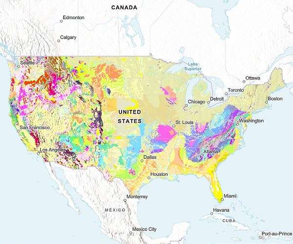
In a major milestone for earth sciences, the U.S. Geological Survey (USGS) has released its most comprehensive national-scale geologic map to date, offering an unprecedented view of the geology both at and beneath the surface across the continental United States.
The new Cooperative National Geologic Map compiles data from more than 100 existing maps and provides the first nationwide platform where multiple layers of geologic information can be accessed in one place. Users can explore the age, composition, and distribution of rock and sediment units, from unconsolidated sand and gravel to ancient bedrock.
"Geologic maps have many uses, such as helping experts look for energy, mineral and water resources," explained Christopher Swezey, coordinator of the USGS National Cooperative Geologic

 Associated Press US News
 CNN
CNN FOX Weather
 FOX 13 Tampa Bay Crime
 CBS News
 Citizen Tribune
 FOX 11 California
 Courier Post Sports