
 Hawaii News Now
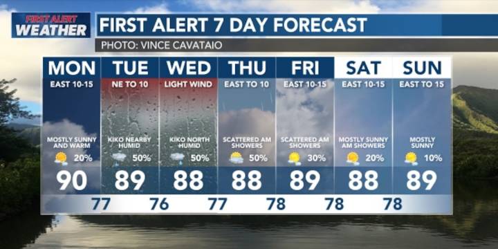
HONOLULU (HawaiiNewsNow) - A dry airmass is expected to move over the state Monday, but clouds, humidity and the chance for showers will increase as tropical cyclone Kiko passes north of the island chain Tuesday and Wednesday.
Kiko will disrupt the trade wind flow, with afternoon sea breezes triggering spotty rainfall for interior areas. There’s a First Alert that there could be isolated downpours and a brief thunderstorm or two can’t be ruled out. It also will be quite humid with dew points in the low to mid 70s. More comfortable trade wind conditions should return Thursday.
The main impact we’re anticipating from Kiko will be high surf for east-facing shores. Waves will slowly rise Monday, and then increase rapidly late Monday into Tuesday, possibly over the 15-foot warning threshold.

 KITV Crime
 FOX News Videos
 AlterNet
 IMDb Movies
 CBS News
 New York Post Video