
 WTNH News 8
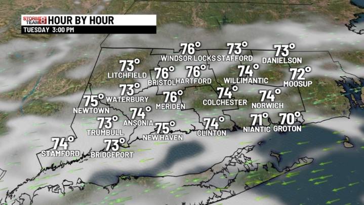
Back under a mix of sun and clouds on Tuesday, and not as warm. The humidity will come down a bit. By Tuesday night into Wednesday, expect a few showers with a developing storm along the North Carolina coast. Thursday and Friday will be dry and warm with highs in the upper 70s to low 80s. The last weekend of Summer looks bright and cooler. Autumn officially arrives at 2:19 pm next Monday!
Tonight: Some passing clouds. Patchy fog. Lows in the 50s.
Tuesday: Sun and clouds, seasonable. Highs in the mid to upper 70s.
Wednesday: Mostly cloudy, cooler with showers likely. Highs in the low 70s.
Thursday: Morning clouds to afternoon sun, warmer. Highs 75-80 inland. Cooler SE Beaches
Friday: Mostly sunny. Warm, highs in the upper 70s to low-80s.
Saturday: Plenty of sunshine, cooler with highs

 WSIL-TV
 Week | 25 News Now
 FOX News
 Raw Story
 MLB
MLB CNN Business
 FOX 32 Chicago Politics
 TODAY Pop Culture