
SALT LAKE CITY (ABC4) — Happy Tuesday, Utah! A passing cold front overnight opened the door for Northwest flow and slightly cooler temperatures for our Tuesday. The upper-level low tracking east north of Utah begins to open up and eject east which will keep some active skies and allow for a few scattered showers and storms across northern UT and southwest WY this morning, including along the Wasatch Front, Uintas, and SW Wyoming. While we will temporarily quiet for the afternoon, a trailing disturbance in the evening will allow for some additional storms in NE Utah. We will see storms development over the Uintas and basin, but isolated storms could reach as far south over Castle Country and Grand County. In the wake of the cold front, we will see slightly cooler daytime highs with temperat
Passing cold front allows for some isolated moisture and cooler Tuesday temperatures
 ABC4 News11 hrs ago
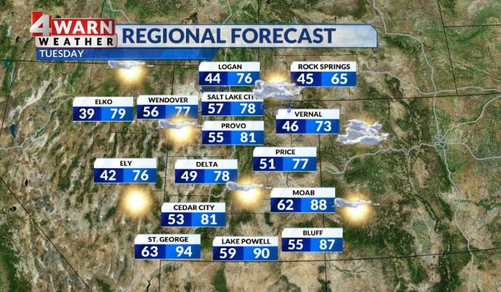
59

 Associated Press US News
 CNN Politics
 The Hill Video