
 NOLA
NOLA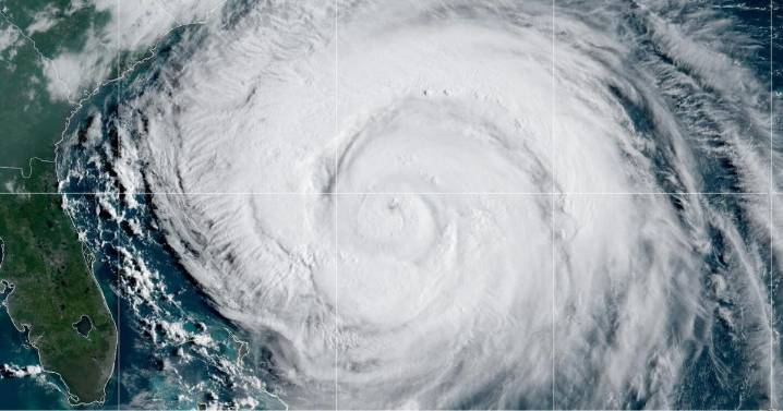
A low-pressure system churning over the Atlantic Ocean is poised to become this year's next named storm. Fortunately for us, forecasters expect the system to curve away from the U.S. as it develops, a path that a majority of this year's six named storms have followed, mercifully avoiding direct hits to land.
That's thanks in large part to what meteorologists call the "Azores high," according to Louisiana State Climatologist Jay Grymes, a semi-permanent ridge of high pressure over a portion of the Atlantic Ocean that steers tropical systems.
“That’s a feature we know tropical systems have to go around," he said.
Grymes likened the Atlantic to a football field, an analogy he credited to a professor he had at LSU. The ridge is a linebacker, and a tropical cyclone is a running back on the

 Local News in Illinois
 America News
 Ocala Star-Banner
 FOX 13 Seattle King County
 Sweetwater Now
 FOX 5 Atlanta Crime
 Week | 25 News Now
 The Columbian
 Sturgis Journal
 Mediaite