
 KOLR10 News
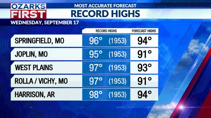
The September sizzle persisted today, and with more sunshine, it got a little hotter. Temperatures climbed into the low to mid 90s. Springfield even managed to tie the record high for the date at 95°.
The 90° streak should persist into at least Wednesday, marking the longest run of 90° days in Springfield since 1983.
Record highs should be out of reach, but not by much.
As for rain, like Tuesday, it looks like drier air east of Hwy. 65 will keep most areas there dry. Spotty afternoon and evening showers and storms will fire up again mainly west of Hwy. 65.
The pattern finally shifts gears on Thursday as a storm system moves through the Upper Midwest. A weak cool front will make it through the area Friday, finally knocking temperatures back to levels more typical for mid-September.
Rai

 News Collection
 People Top Story
 Blaze Media
 People Shopping
 Raw Story
 IndyStarSports
 IMDb Movies
 Fast Company Lifestyle
 Grist
Grist