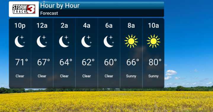
Well folks, it's certainly shaping up to be a hot one as we head towards the end of the week. We're seeing temperatures that are not only above average but are really going to push those "hot" descriptors, with highs commonly in the 90s, and we could even flirt with some mid-90s today. We're closely monitoring the fire danger conditions given this extreme heat and dry spell, although light winds and tree cover offer some slight moderation.
Looking ahead, we'll start to see a shift in the weather pattern. While chances for rain are minimal for many of us tonight and tomorrow, the models suggest that a more active pattern could be developing. As we move through the weekend and into early next week, this pattern evolution could bring more widespread cloud cover and a better opportunity for r

 WSIL-TV

 WEVV 44News
 Raw Story
 CBS News Video
 OK Magazine
 The Atlanta Journal-Constitution Sports