
Download the 27 StormTrack Weather app to receive mobile weather alerts After once again reaching temperatures in the mid to low 80s throughout Southern Wisconsin, increasing cloud cover and even a few stray showers have started settling back into the southwestern corner of the state. A core of low pressure centralized over of Iowa is helping to force more moisture northward in the Southwestern Wisconsin and in turn, producing rain showers. Fortunately, dewpoint values at the surface remain fairly low, meaning that the majority of our rain chances will be minimal at best throughout the upcoming evening. Expect temperatures gradually dwindling from 77° around dinnertime to 70° by 10 o’clock under mainly cloudy to overcast skies. We will wake up to a morning low temperature near 62° on F
Rainfall returning to Southern Wisconsin
 WKOW 272 hrs ago
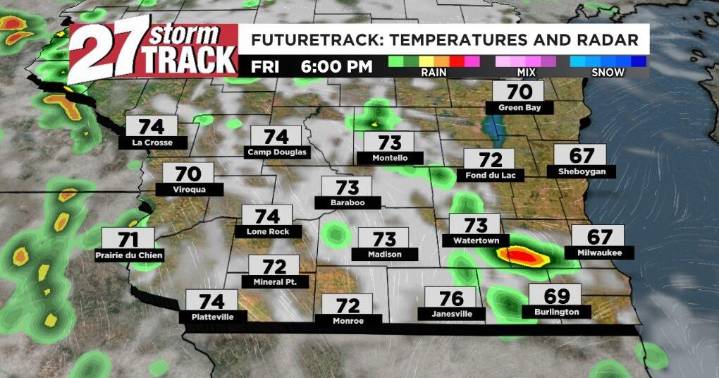
148

 KTVU San Francisco
 KKTV 11 News