
 WMTV NBC15
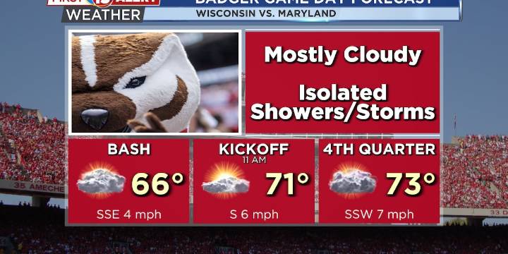
Highs in the low to mid-70s today
Additional chances for showers and storms Monday
Cooler and less humid by the end of the week
MADISON, Wis. (WMTV) - A broad upper-level trough will remain over the Northern Plains and Upper Midwest through the weekend, bringing scattered showers and a few thunderstorms today and into Sunday. The highest chances occur this afternoon and again late tonight into Sunday morning as additional disturbances move through the trough of low pressure. Temperatures will be slightly cooler today due to cloud cover and rain chances but will still remain near to slightly above normal, with highs in the low to mid 70s. Overnight lows will remain on the warmer side in the upper 50s to low 60s. Click Here for Interactive Radar
What’s Coming Up...
Heading into the wo

 NBC26
NBC26 TMJ4 News
 Atlanta Black Star Entertainment
 Raw Story