
 WAAY TV
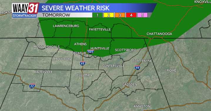
The start of fall could bring some strong to severe storms for the beginning of the work week.
For the rest of the evening we could see a pop-up shower or two, but most of us will experience partly cloudy skies. Lows will sit in the mid to upper 60s.
Both Monday and Tuesday feature a marginal 1/5 risk for strong to severe storms in the afternoon, the only difference is the location. Monday's is for areas north of the Tennessee River, while Tuesday really only focuses on the NW part of our viewing area. Main threats will include heavy rainfall, damaging winds, and hail.
Rain and storms are expected on Wednesday as well, but as of right now we are not outlined in a severe weather threat. We will continue to monitor this as we inch closer to mid week.
High temperatures to start off the we

 Associated Press US and World News Video
 FOX 10 Phoenix Latest
 NECN Providence
 KSNB Local4 Central Nebraska
 Florida Today
 KPTV Fox 12 Oregon
 News 5 Cleveland
 The Hollywood Reporter