
 WJZ CBS Baltimore
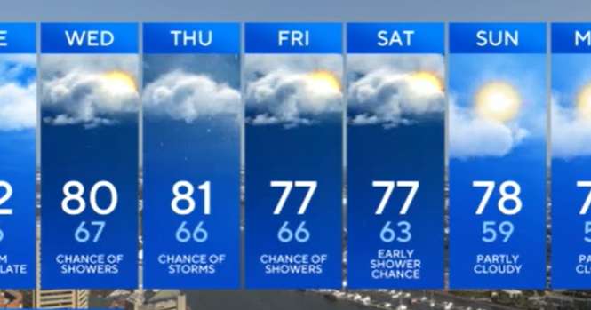
Most of today looks dry for the Baltimore metro, though a few showers and storms develop mainly west of the mountains later. For us, the bigger story arrives in stages over the next several days as a sluggish cold front creeps in from the Ohio Valley and stalls nearby.
Tonight: Mild and a bit sticky with lows in the low to mid-60s around town and upper 50s in the coolest suburbs. Patchy late-night fog may form in the usual low spots and near area waterways.
Tuesday: The high weakens and moisture increases. We'll see intervals of sun and clouds with a stray, brief shower possible late day northwest of the city; most neighborhoods stay dry. Highs again in the upper 70s to low/mid-80s.
Wednesday: The front sags into the region and lingers. Expect mostly cloudy skies with scattered to, a

 WBAL NewsRadio
 The Baltimore Sun
 Hello Magazine
 Pajiba
 OK Magazine
 New York Post
 AlterNet
 Reuters US Top