
 NBC Connecticut
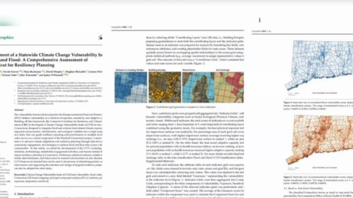
As climate change drives more extreme weather, including wetter floods and hotter heat waves, researchers are developing tools to help us better plan for the future.
One tool is called the Connecticut Climate Vulnerability Index and it looks at places in our state that are most susceptible to flooding and excessive heat.
Stream Connecticut News for free, 24/7, wherever you are. WATCH HERE
After Superstorm Sandy battered the Connecticut coastline with storm surge up to 10 feet, a study was initiated to analyze the resiliency of the coast.
Now, after several years of work, it has evolved into a statewide mapping tool looking at the susceptibility to not only flooding, but excessive heat.
“This is something that is supposed to layout this strategic vision for the community in terms of

 The Journal Gazette
 CBS News Video
 Essentiallysports College Sports
 FOX News
 CNN
CNN Scientific American Health