
 Times-Tribune
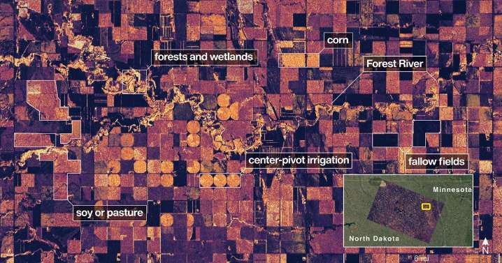
CAPE CANAVERAL, Fla. (AP) — NASA's first radar images from a new Earth-mapping satellite show the Maine coast and Minnesota farmland in incredible detail.
The pictures, released Thursday, are from a spacecraft that rocketed into orbit from India two months ago.

 LiveNOW from FOX Crime
 SpaceNews
 The Babylon Bee
 The List
 Fox 11 Los Angeles Sports
 The Daily Beast
 PBS NewsHour Video
 AlterNet