
 7News Boston WHDH
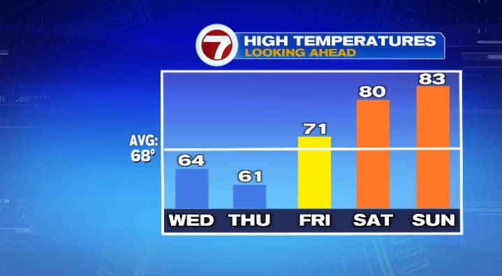
A big temperature cooldown is coming this week, however it’s not going to last long before it’ll be unusually warm once again.
Overnight lows will be cooler than the last few mornings, overall in the upper 40s and low 50s under mostly clear skies. Wednesday will feel like the coldest day this week, thanks to a combination of the temperature cooldown and some gusty winds. Highs will only reach the low to mid 60s, but winds will gust to 25 mph and that’ll make it feel like the 50s during the warmest part of the day. At least the sun will be shining!
Thursday will be the technically coolest day of the week, but given we won’t have much of a wind it’ll likely feel slightly warmer than Wednesday. Highs will top off in the low 60s after a cold morning in the 30s with bright skies once again.

 The Boston Globe Crime
 MassLive
 Community Impact Newspaper
 ABC 7 Chicago Politics
 FOX Weather