
 KPAX
KPAX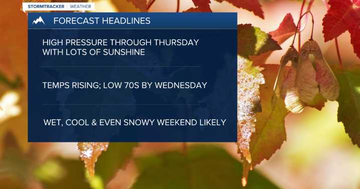
MISSOULA — High pressure has settled in allowing for mainly clear skies, patchy morning fog, lighter winds and warming temps! Weather Forecast: 10.7.25
Highs should top out in the mid 60s to around 70 for Tuesday and in the upper 60s to low 70s Wednesday and Thursday.
Erin Yost
The ridge will begin to flatten Thursday night allowing a southwesterly flow to develop. This will increase cloud coverage a bit for Friday and allow for an isolated thunderstorm or two to develop during the afternoon/evening for mainly southwest Montana. Highs will remain warm topping out in the upper 60s to almost mid 70s.
As of now, the weekend looks to feature a BIG pattern change to unsettled & cool conditions as a trough of low pressure moves in.
Snow levels will start off quite high Friday around 9,000’

 FOX News
 News 5 Cleveland Politics
 NBC News
 New York Post