
 ClickOrlando
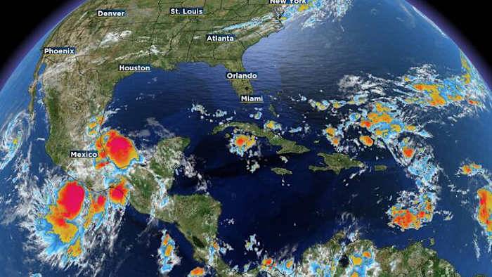
ORLANDO, Fla. – Tropical Storm Jerry is our current named storm on the board moving rapidly west, northwest towards the upper Leeward Islands of the Caribbean Sea.
Other than Jerry, however, the Atlantic has been very tame and almost benign throughout the hurricane season so far.
There is some low-end potential for more storm formation over the coming weeks, but Climate Prediction Center emphasizes the chances could be higher than initially meets the eye. So I want to spend some time breaking down what we need to know as we continue through this month, and then the homestretch to Nov. 30. The updated hazards map released yesterday mid-day, with the greatest chances for future development being pointed out the western Caribbean and the lower Gulf (Copyright 2025 by WKMG ClickOrlando -

 FOX Weather
 News4JAX
 News on 6
 Siskiyou Daily News
 The Oakland Press
 New Jersey News
 Chicago Tribune
 Eyewitness News 3
 Ocala Star-Banner
 FOX 32 Chicago
 KTVU San Francisco
 News 5 Cleveland
 KETV NewsWatch 7
 AlterNet