
 21Alive News
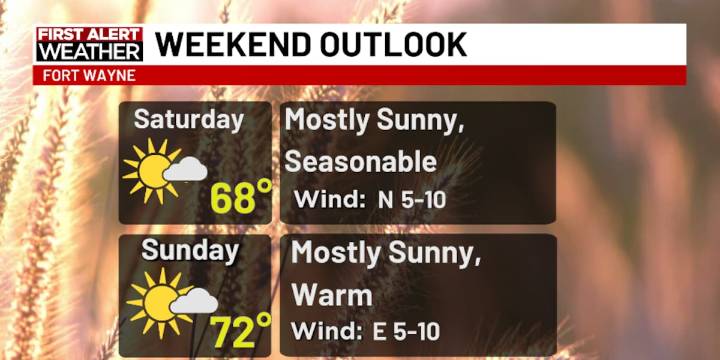
FORT WAYNE, Ind. (WPTA) - We’ve had some chilly mornings lately, but the majority of the area avoided a freeze. This means the growing season is still in tact, though not as robust as it once was, which is to be expected this time of year!
A ridge of high pressure to our west will strengthen and expand eastward over the weekend, allowing highs to go from the upper 60s Saturday to the low (possibly mid?) 70s Sunday. Monday and Tuesday will be the warmest days over the next seven with highs in the mid 70s.
Temperatures will return, briefly, to the 60s Wednesday and Thursday of next week before rising into the low 70s again on Friday. By that point, a chance of light rain returns to the forecast. At this point, amounts would be very light, possibly not even exceeding a tenth of an inch.

 WOWT
WOWT RadarOnline
 The Journal Gazette
 The Shaw Local News Sports
 @MSNBC Video
 NBC Southern California Entertainment
 Associated Press US News
 Bored Panda
 Raw Story