
 San Gabriel Valley Tribune
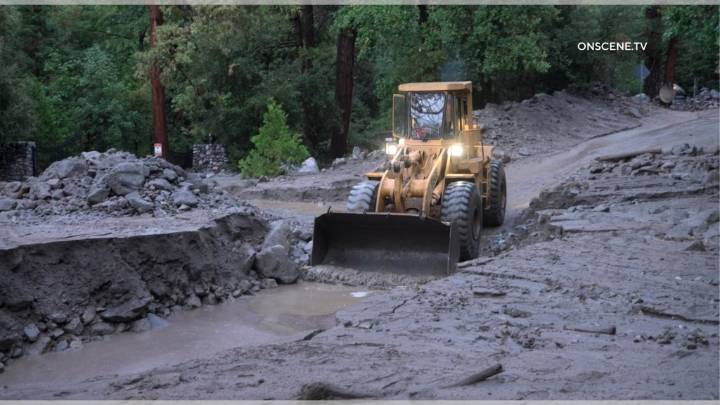
The storm this coming week could produce faster rainfall rates than previously expected , increasing the risk of flooding and debris flows in Los Angeles County burn scars, meteorologists warn.
“We’re now focusing most of the impacts in a 24-hour window from Monday night to Tuesday night,” said National Weather Service meteorologist Dave Gomberg. “We have to start thinking about flooding and debris flows in recent burn scars.”
Earlier forecasts suggested a modest, slow-moving system, but updated data show the potential for more intense bursts of rain. While overall rainfall totals are still expected to remain the same — about a half-inch to 1.5 inches in most lower elevations and up to 2 inches in the foothills — the enhanced rate of rainfall is what raises concern, said NWS meteorolog

 NBC News
 KSL Utah
 FOX Weather
 Newsday
 NewsChannel 5 Nashville
 Voice of Alexandria Sports
 FOX News Politics
 ESPN NHL Headlines
 5 On Your Side Sports
 Atlanta Black Star Entertainment