
 NOLA
NOLA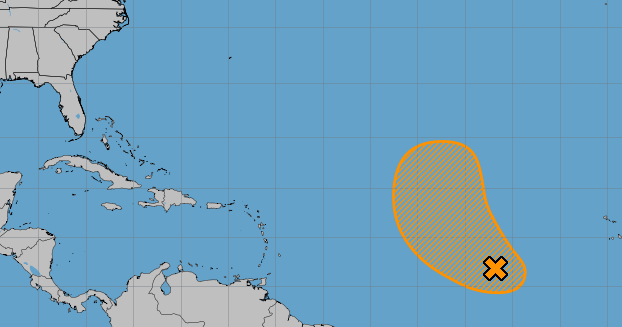
An area of low pressure west of Africa could very well become this year's next named storm, but State Climatologist Jay Grymes said it's not likely to reach the U.S.
The system was producing a large area of showers and thunderstorms as of 1 p.m. Sunday, according to forecasters with the National Hurricane Center in Miami. It could develop in the coming week as it moves west-northwest or northwest over the Atlantic, forecasters said.
As of Sunday afternoon, the system had a 40% chance of becoming a tropical depression or storm in the next two days and a 50% chance in the next week.
Grymes said the latest hurricane models show the system churning out at sea without reaching land, staying well away from the U.S. and possibly even looping back around to warmer waters.
"But even that would

 FOX News
 Newsday
 Cowboy State Daily
 FOX Weather
 The Columbian
 KSL Utah
 Detroit News
 The Hill Politics
 AlterNet