
 KEZI 9 News
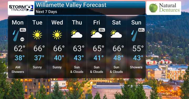
We've been monitoring the upper-level patterns, and it confirms that a low-pressure system moving south will keep things unsettled and cool through early next week. We can expect occasional heavier rain showers, especially near the foothills of the Cascade Range. There's even a small chance for thunderstorms today, mainly along the coast and in the Coast Range. For those heading up into the higher Cascades, snow accumulation is on the table, with a Winter Weather Advisory in effect for elevations above 4000 feet, bringing what could be several inches of wet snow to the passes, which is definitely something we'll be keeping a close eye on.
Daytime highs are running below average, generally staying in the mid-50s to low 60s across the valley floor, with much colder temperatures, in the uppe

 America News
 Post Register
 The Fayetteville Observer
 NBC News Video
 WBRC
WBRC People Top Story
 The List
 MLB
MLB