
 USA TODAY National
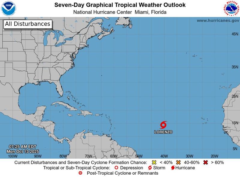
Tropical Storm Lorenzo formed on the morning of Oct. 13 far out in the Atlantic Ocean, forecasters from the National Hurricane Center said. Fortunately, the storm poses no threat to any land areas, and "there are no coastal watches or warnings in effect," the hurricane center said.
Lorenzo is the 12th named storm of the 2025 Atlantic hurricane season and the third storm to form since Oct. 1. The 2025 season continues to rack up named storms, though few are directly impacting any land areas. A typical season, based on data from 1991 to 2020, has 14 named storms, according to Colorado State University forecasters.
The Atlantic hurricane season runs until Nov. 30.
Where is Tropical Storm Lorenzo?
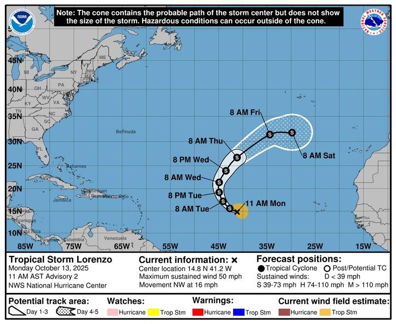
As of 11:00 a.m. EDT, the center of Tropical Storm Lorenzo was located in the central tropical Atlantic Ocean, about 1,150 miles west of the Cabo Verde Islands. It had maximum sustained winds of 50 mph, with higher gusts, and was moving to the northwest at 16 mph.
This motion is expected through tonight, followed by a turn northward on Oct. 14. It's then forecast to loop back toward the islands off the coasts of Africa and Portugal.
Although not unheard of, it’s rare for a named storm to form this far east in the deep tropics (south of 20 degrees North Latitude) this late in the hurricane season, said WPLG-TV hurricane specialist Michael Lowry in a Substack post. "The last time we saw such an occurrence was back in 2003 when both Nicholas and Peter formed unusually late and far east over the Atlantic Main Development Region, an area typically reserved for August and September formations," Lowry said.
How strong will Lorenzo get?
"Little change in strength is forecasted today (Oct. 13), but some gradual intensification is possible by the middle portion of this week," the hurricane center said.
In fact, weather models vary widely on how strong Lorenzo could get in the coming days, ranging from a weak tropical storm to a Category 2 hurricane, the hurricane center said. A Category 2 hurricane has maximum sustained winds ranging from 96 to 110 mph.
As of Oct. 13, tropical-storm-force winds extend outward up to 160 miles from the center of Lorenzo.
Lorenzo not related to the East Coast nor'easter
Lorenzo formed right after a powerful nor'easter, the first of the season, started bringing dangerous waves, high winds and heavy rain to the U.S. East Coast.
The two systems are not related to one another.
As the nor'easter moves north, forecasters warned it could continue to bring hazards to coastal communities from Virginia to Massachusetts, including power outages, travel disruptions, and marine dangers with seas topping 10 feet, according to the National Weather Service.
Contributing: Cheryl McCloud, USA TODAY NETWORK - Florida
This article originally appeared on USA TODAY: Tropical Storm Lorenzo forms in the Atlantic. Is it a U.S. threat?
Reporting by Doyle Rice, USA TODAY / USA TODAY
USA TODAY Network via Reuters Connect

 Asheville Citizen Times
 Florida Today
 Hattiesburg American
 FOX News
 Associated Press US News
 The Traverse City Record-Eagle
 FOX Weather
 The Weather Channel
 WKYT
WKYT Bolavip Football
 New York Post